


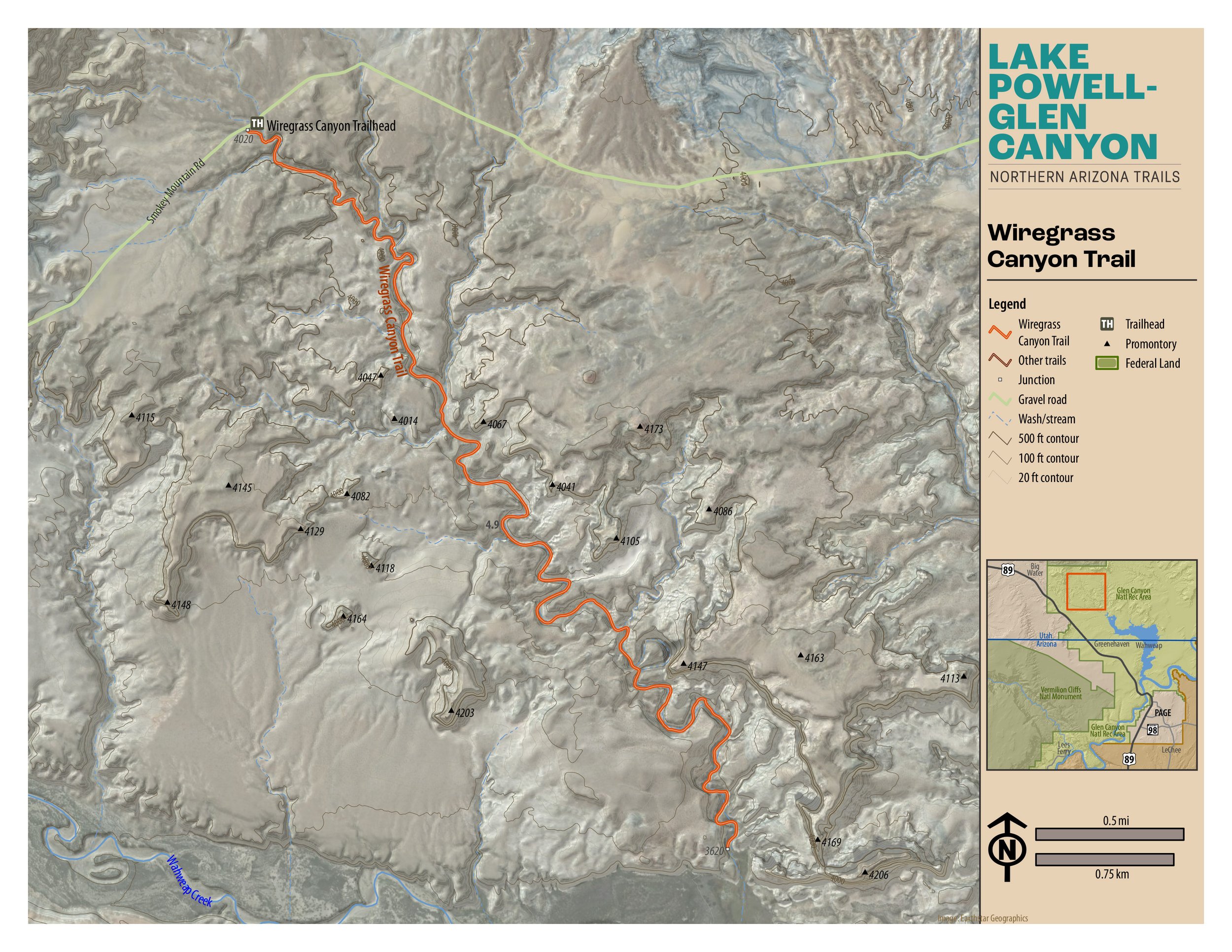
Wiregrass Canyon Trail
“Enter the geologic world of the Entrada Sandstone, a formation easily eroded by the forces of wind, water, and ice. At trail’s end witness the same geologic structure that created Rainbow Bridge, well into its beginning stages.”

Moderate
7.3 miles (11.75 km)
Hiking
After some relatively steep ascents and descents on this trail in Glen Canyon National Recreation Area, at .6 miles you reach the base of the wash. The trail is to the left. The trail to the right leads to a pour-off with plunge pool at approximately 125 yards. Explore and return. The remainder of the trail is relatively flat. At mile 3.65 you reach a hole in the wall where water has created an alternate path through the rock. Return to the trailhead from this point.
DO NOT ATTEMPT IN WET WEATHER. THIS IS A FLASH FLOOD AREA.
GET THE APP. GET THE MAP.®
Download the Avenza Maps App and create an account. It’s free!


Directions
From the intersection of Lake Powell Blvd. and North Navajo Drive in Page, the trailhead is 21.7 miles (34.92 km). Drive northwest on Lake Powell Blvd. and merge onto HWY 89 north. Cross over Glen Canyon Dam and continue northwest on HWY 89. At mile 16.8 turn right onto Ethan Allen Drive in Big Water, UT. At mile 17.1 turn right at the HWY 12 sign. Descend to a small creek crossing as you move onto Smokey Mountain Road. The trailhead is on your right at mile 21.7.
Click map below to navigate to trailhead.
Trail Details
Trailhead Coordinates: 37°04'38.7"N 111°35'22.6"W
Trail Access: National Park Service, U.S. Fee Area
Trail Surface: Slickrock, earth, sand, clay
Trail Condition: Moderately developed
Trail Use Type: Hiking
Best Season: Year round, prepare for heat in summer, snow and ice in winter
Parking at Trailhead: Yes
Restroom / Water: No
Pet Friendly: No, some relatively steep drop offs and climbs
Degree of Difficulty: Moderate
Trail Type: Out and back
Trail Length: 7.3 miles (11.75 km) out and back, 3.65 miles (5.87 km) one way
Elevation Gain / Loss: 288’
Elevation at Trailhead: 4031’
Cell Service: Intermittent
Land Manager: National Park Service (NPS) - Glen Canyon National Recreation Area (GCNRA)


