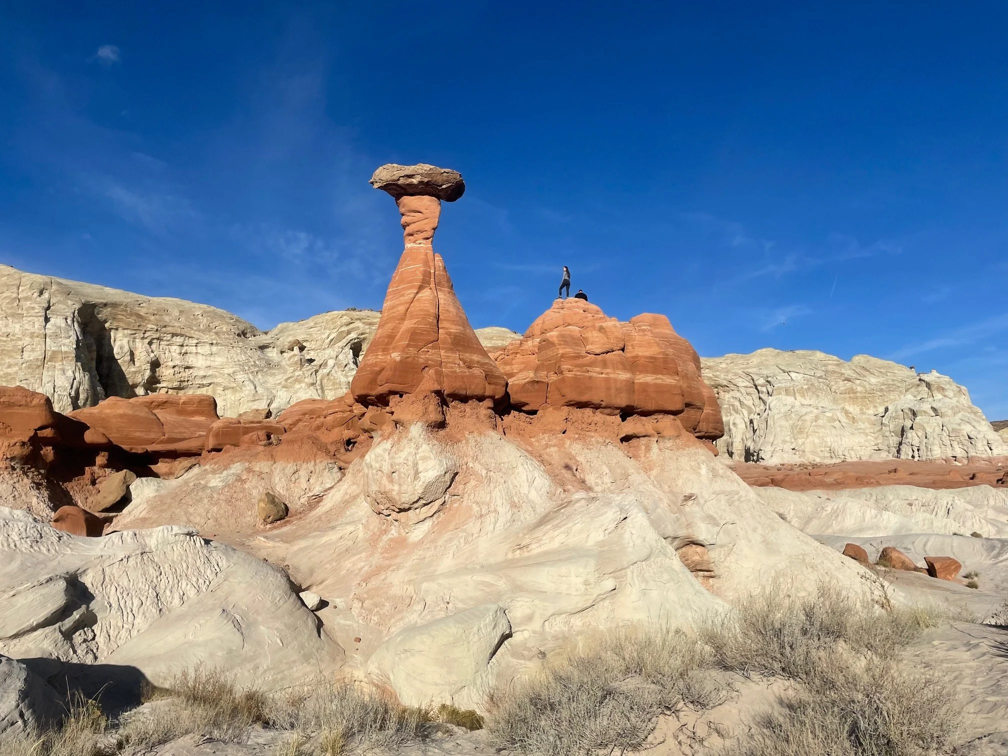
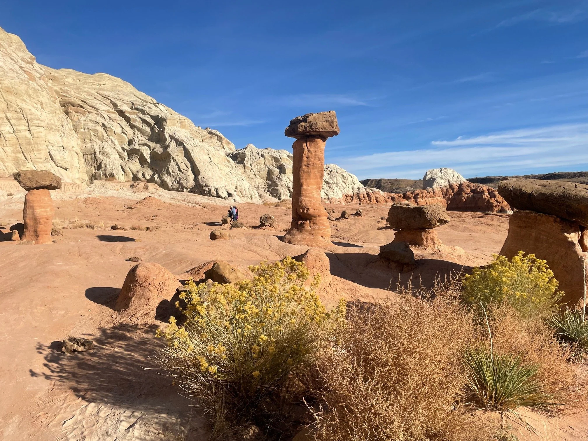
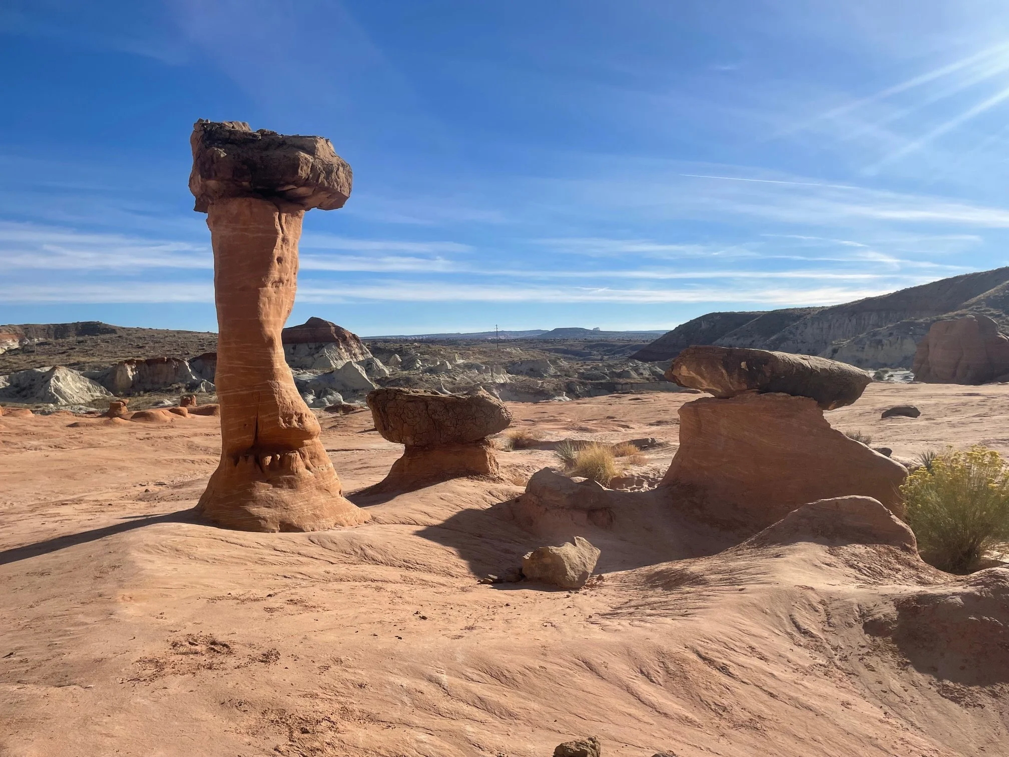
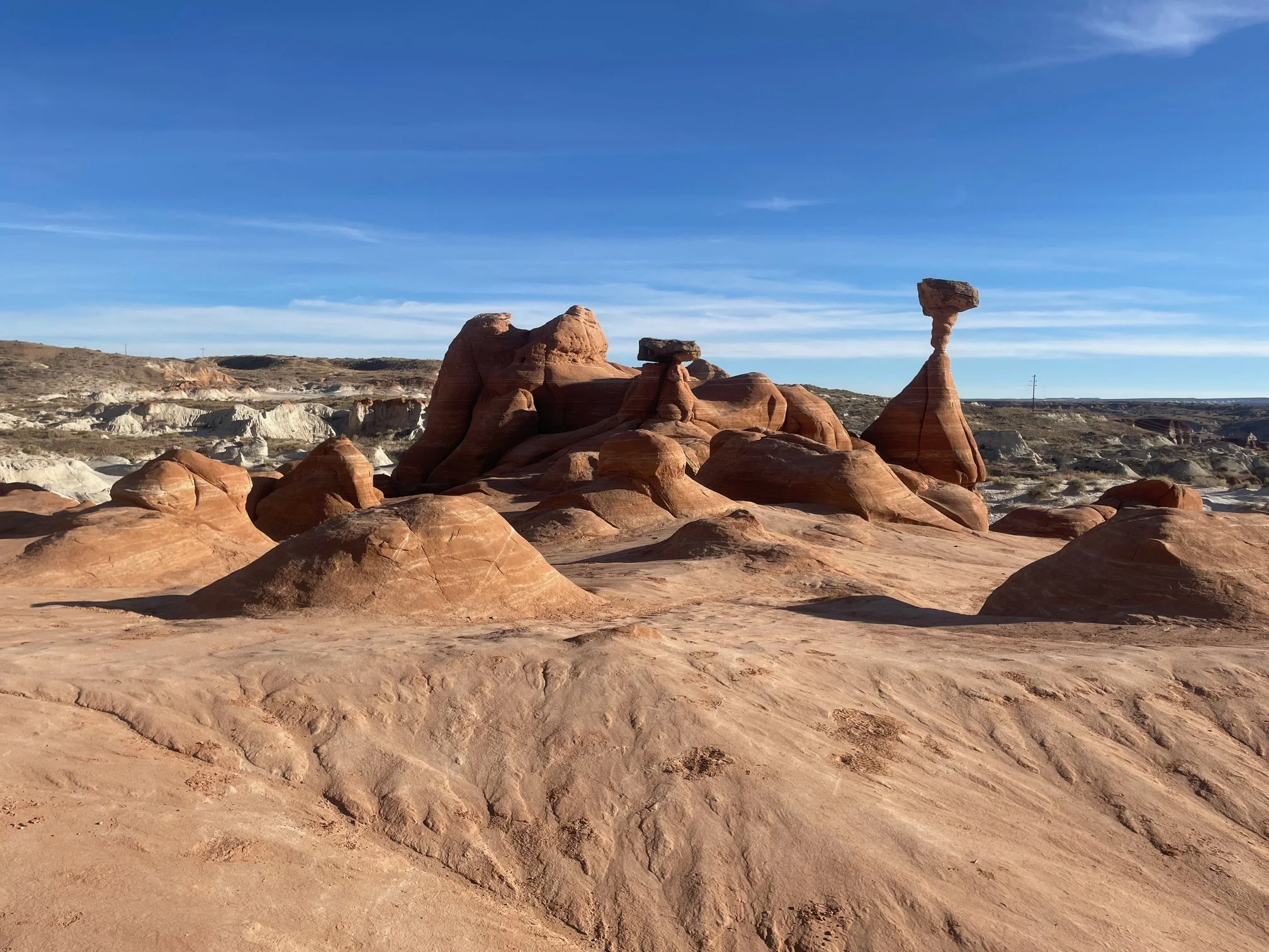
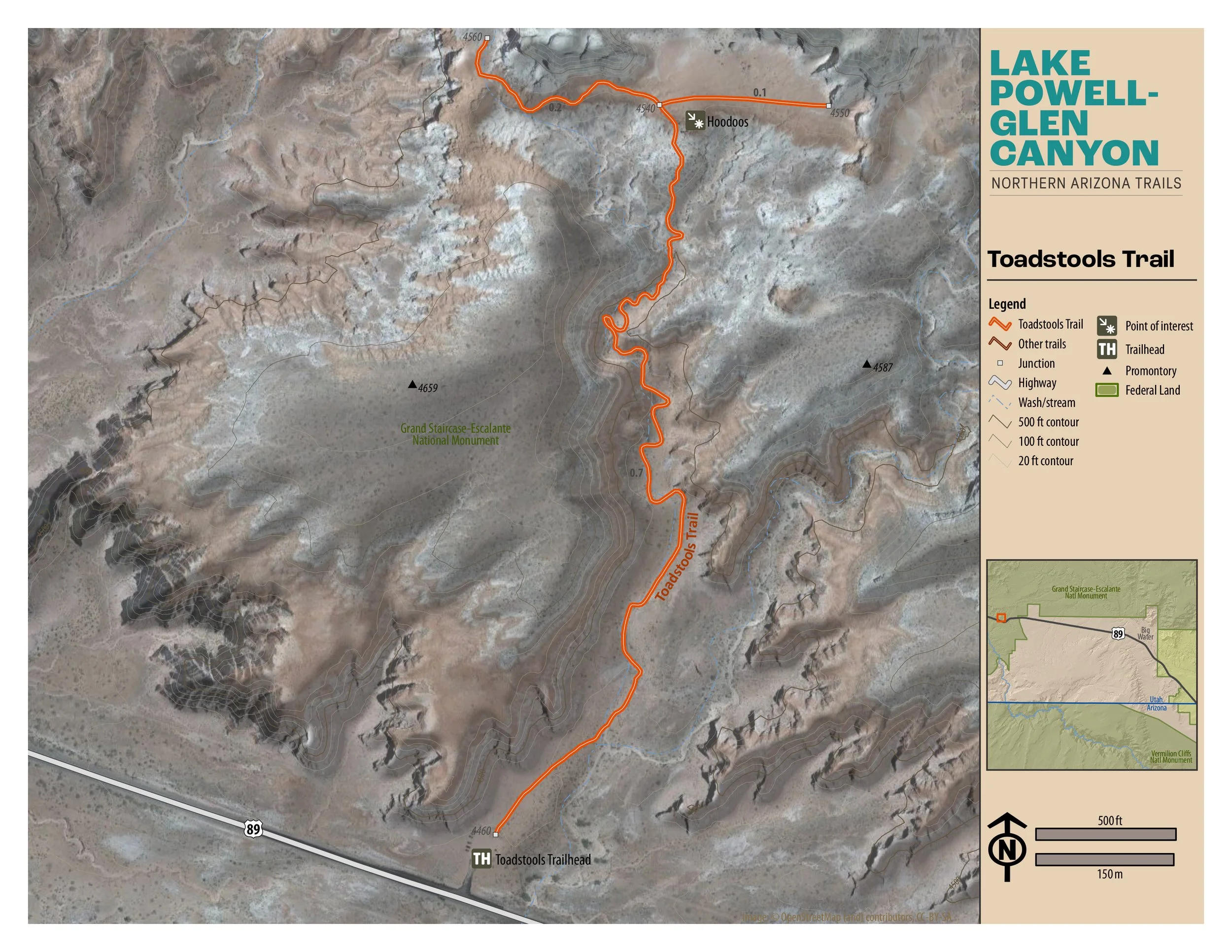
Toadstools Trail
Located in Grand Staircase-Escalante National Monument, The Toadstools offers a great place to explore. “A wonderful journey into the geologic world of hoodoos”

Easy
1.74 miles (2.8 km)
Hiking
A relatively flat trail from the trailhead leading to an 85’ ascent to the hoodoos. The hoodoos look like toadstools, umbrella shaped. Once up on the lower level of the formation, take your time and feel free to explore the area, then return to the trail.
GET THE APP. GET THE MAP.®
Download the Avenza Maps App and create an account. It’s free!


Directions
From the intersection of Lake Powell Blvd. and North Navajo Drive in Page, drive north and west on Lake Powell Blvd. and merge with HWY 89 north. Cross over Glen Canyon Dam and continue north and west on HWY 89. Enter the state of Utah. Distance from the intersection to the trailhead on your right is 28.5 miles, (45.87 km).
Click marker below to navigate to trailhead.
Trail Details
Trailhead Coordinates: 37º6.0770N 111º52.3923W
Trail Access: Free and open to the public
Trail Surface: Earth, sand, slickrock
Trail Condition: Moderately developed
Trail Use Type: Hiking
Best Season: Year round, prepare for heat in summer, snow and ice in winter
Parking at Trailhead: Yes
Restroom / Water: 2 Sani cans, no water
Pet Friendly: Yes, leash required for pets
Degree of Difficulty: Easy
Trail Type: Out and back
Trail Length: 1.74 miles (2.8 km) out and back,
.87 miles (1.4 km) one way
Elevation Gain / Loss: 85’ ascent
Elevation at Trailhead: 4464’
Cell Service: Intermittent
Land Manager: Bureau of Land Management (BLM) – Grand Staircase-Escalante National Monument